AerialGuard
Detect and track tiny vehicles and pedestrians in high-altitude UAV imagery where scale variance breaks standard detectors.
- Problem
- Tiny, dense targets in high-altitude UAV imagery break full-frame detectors.
- What I built
- A SAHI + YOLOv11 aerial detection and tracking pipeline with a Streamlit UI.
- My role
- Project author: detection workflow, SAHI, tracking, data versioning, delivery.
- Result
- Recorded dense aerial detection and Bot-SORT tracking on real traffic footage.
Evidence
More recorded proof
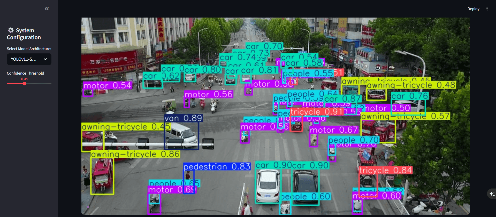
Dense aerial detection output
A recorded Streamlit inference screenshot with detector labels and confidence values over dense aerial traffic. It is a representative UI output, not a measured evaluation or a full-frame-versus-SAHI comparison.
Problem
What this project had to solve
High-altitude UAV imagery creates extreme scale variation, dense overlap, and tiny targets that standard full-frame object detection can miss.
Role / contribution
What I owned in the system
Project author responsible for the aerial detection workflow, SAHI integration, tracking path, experiment and data versioning, and the Streamlit/Docker delivery described in the repository.
Architecture flow
System flow from input to output
Aerial input
What happens
A high-resolution UAV image or video enters the local Streamlit workflow.
Why it matters
The input domain contains crowded scenes and very small objects, so evidence must reflect aerial-scale conditions.
Related tools
Engineering decisions
Tradeoffs that shaped the build
Decision 01
Use slices for tiny targets
SAHI addresses resolution loss for small aerial objects by evaluating overlapping crops instead of resizing the full scene once.
Decision 02
Keep detection and tracking distinct
YOLOv11 provides frame detections; Bot-SORT adds identity association across frames.
Decision 03
Keep the workflow inspectable
The Streamlit interface exposes detections, while MLflow and DVC record the experiment and data workflow described by the repository.
Technical implementation
How the system is built
The project fine-tunes YOLOv11-Small for aerial traffic imagery and uses SAHI to slice high-resolution scenes for small-object inference.
Bot-SORT maintains vehicle and pedestrian identities across video frames after detection.
MLflow, DVC, Docker, Streamlit, and GitHub Actions organize the experiment and delivery workflow; the repository also documents Trivy scanning.
Stack
Core tools and system layers
Limits and next steps
What is not done yet
- Compare full-frame and SAHI inference on the same held-out scenes with recorded latency and detection metrics.
- Report tracking metrics and difficult occlusion cases alongside the current visual examples.
- Explore the repository's proposed OSNet or CLIP re-identification path for longer occlusions.
Project explainer
Ask about this project
A case-study guide to the architecture and decisions behind AerialGuard.